REEPS +Living LakesWater Resource Mapping Project
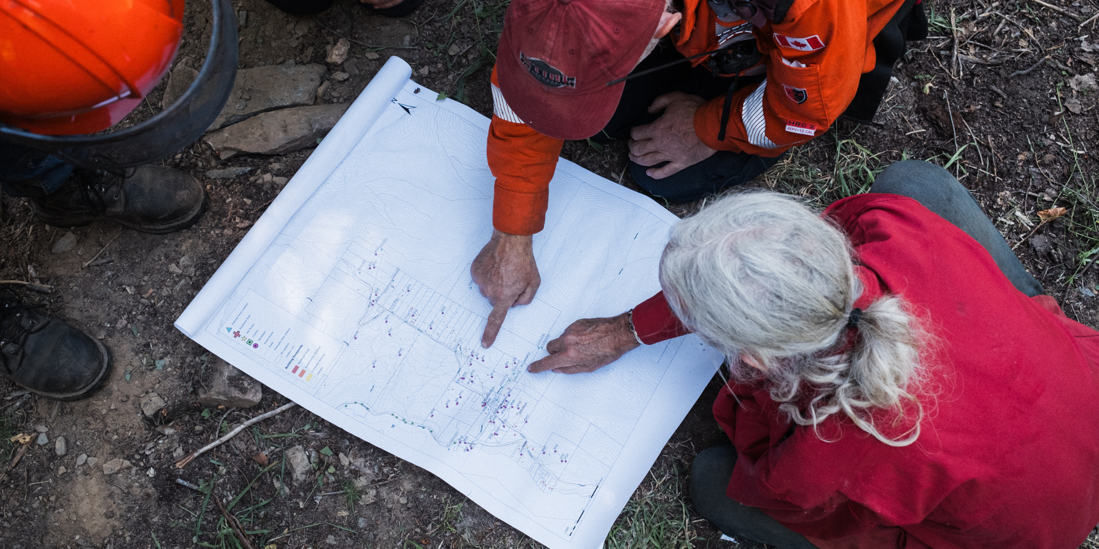
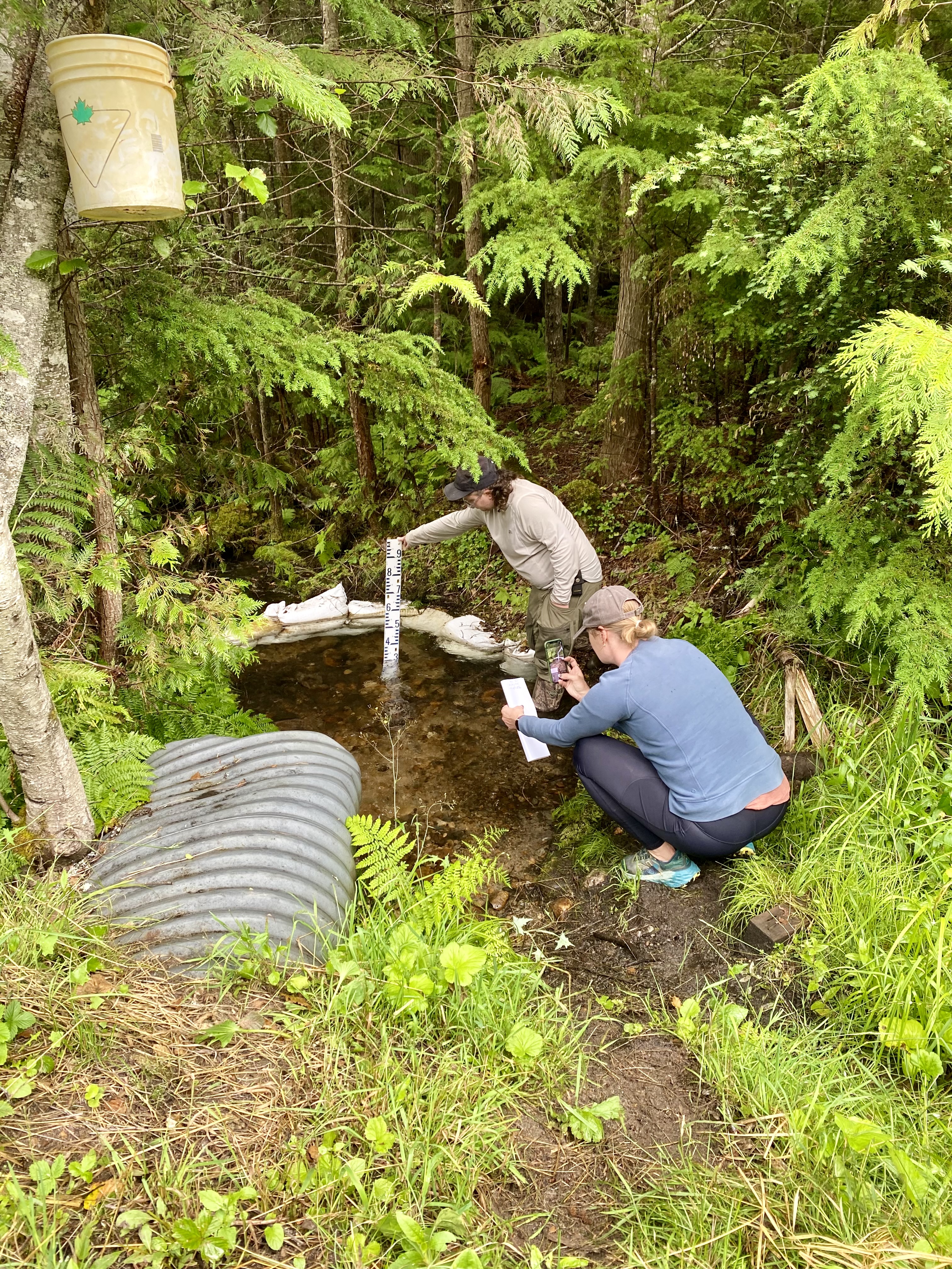
REEPS is partnering with Living Lakes Canada on the Water Resource Mapping to Support Wildfire Response program. By combining community knowledge with water data, we are helping to identify local sources that fire crews can use during an emergency.
Participation is voluntary and information from private land is only included with permission from landowners and residents. We will be sharing more information about the project and how to participate soon.
We held a Community Meeting on June 10th at the Silverton Memorial Hall to learn more about the project and how to get involved. For more information, please contact us at info@reeps.ca or Living Lakes Canada at wildfire@livinglakescanada.ca.
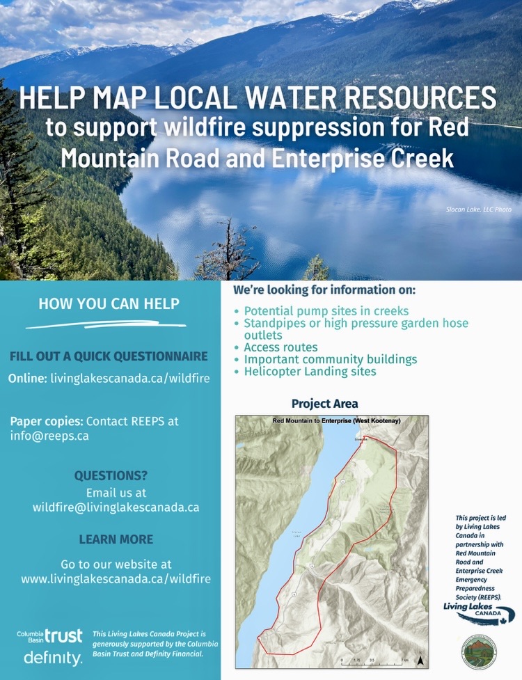
The map below shows the outline of the area we are mapping.